Welcome
At CBE Surveys we provide industry leading drone surveying solutions, running the very latest in fixed wing GPS RTK drone technology.
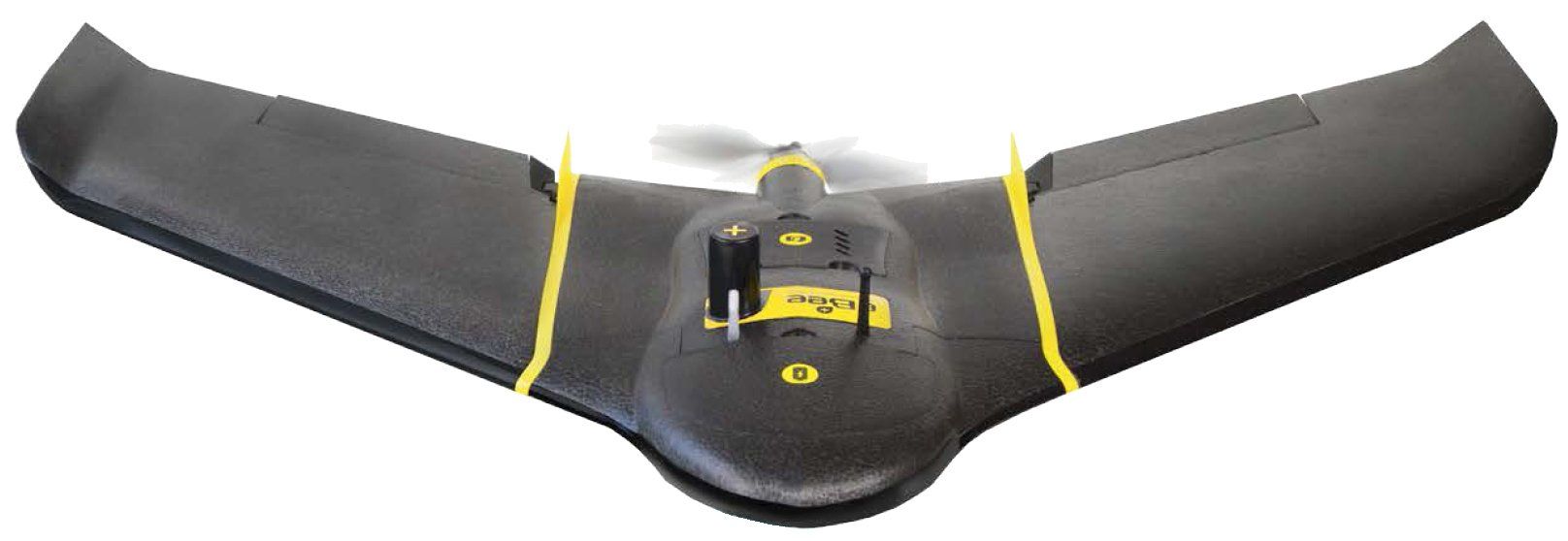
with our Sense Fly Ebee X we can provide complete site surveys down to absolute accuracy of 3cm.
Our Fully CAA Licensed pilots can provide you with surveying solutions to meet every need.
With over 12 years experience in the construction industry as a engineer and surveyor, were confident we can provide you with a service that will open up the possibilities for greater understanding of your sites .
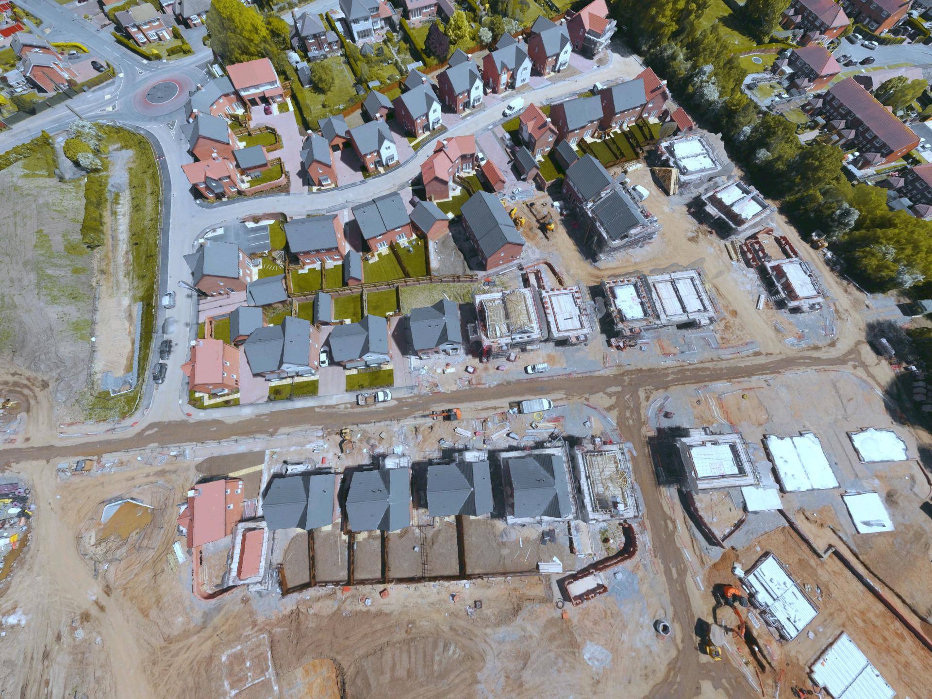
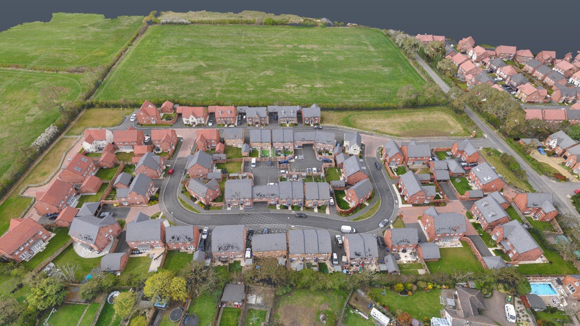
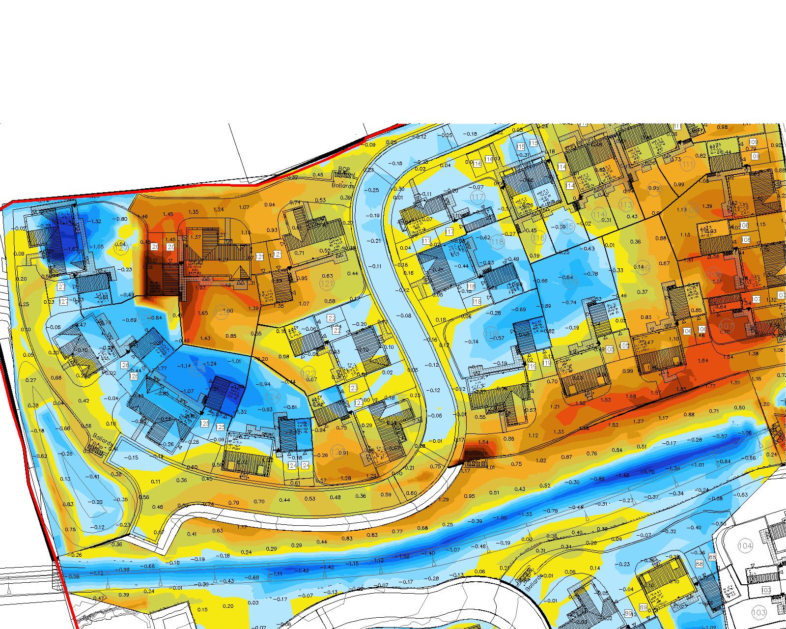
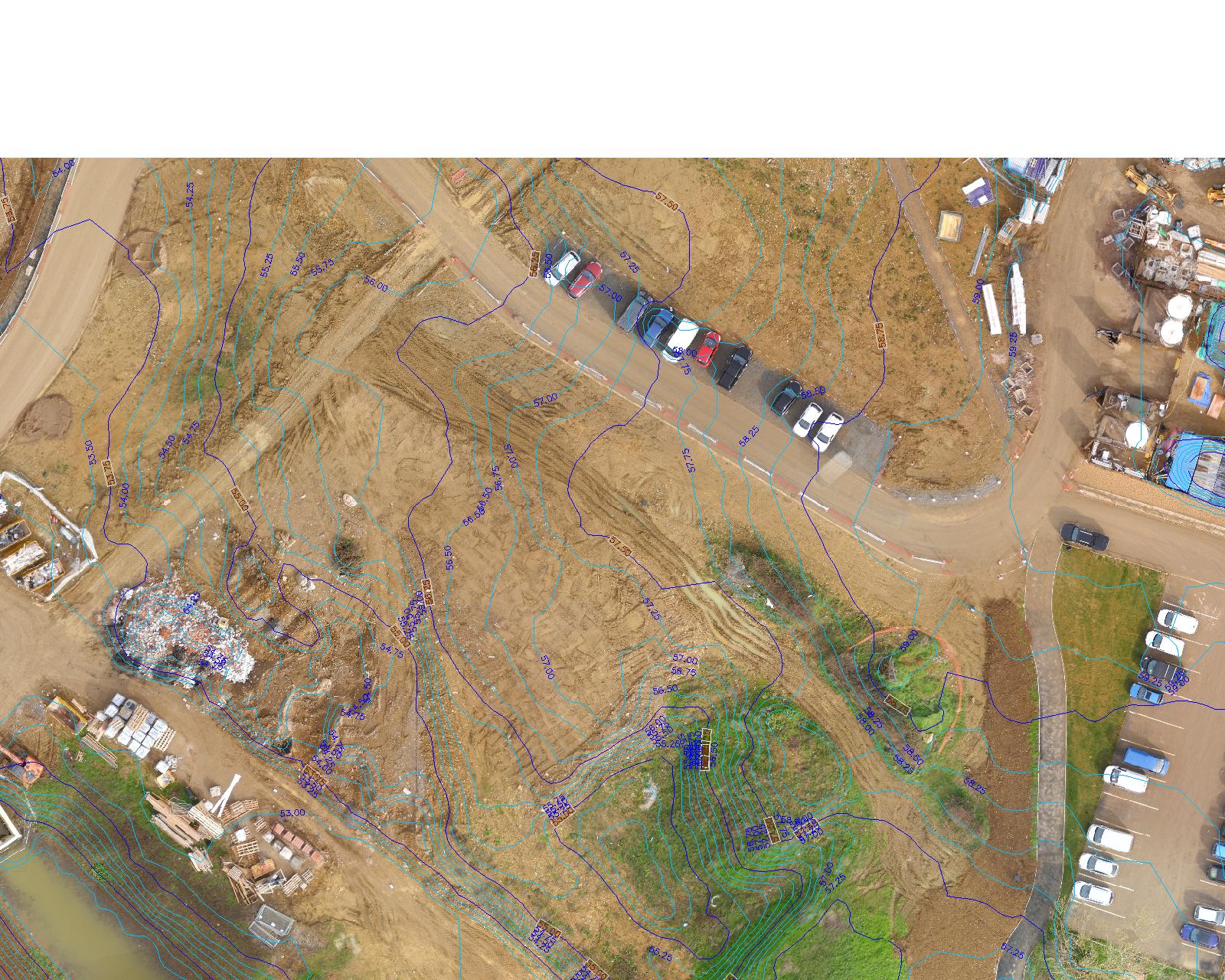
- Densified 3D point cloud data, allowing for detailed contour maps, volume calculations and Cut and Fill analysis
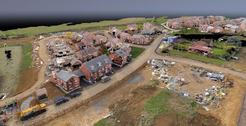
- 3D Textured mesh models, giving you a full 3d model of your site. along with video animation fly overs.
- Geo Referenced 2d Ortho mosaics, allowing for full conformity checks and As-Built information
- Along with Hi Definition photography of your site
All this can be achieved to a greater quality and in a fraction of the time at at a fraction of the cost of traditional surveying methods
Contact us for more information we cover the whole of the UK
info@cbesurveys.co.uk
Sense Fly Ebee XMap without limits
Point Clouds
3D point cloud data. The backbone of all the survey solutions we provide. Immense 3D data due to the use of the S.O.D.A 3D camera providing unrivalled point density and accuracy.
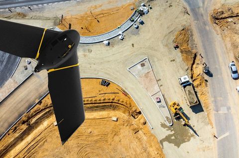
eBee X fixed-wing drone
Industry Leading Technology- with the latest in GPS RTK Technology and Hi Definition cameras
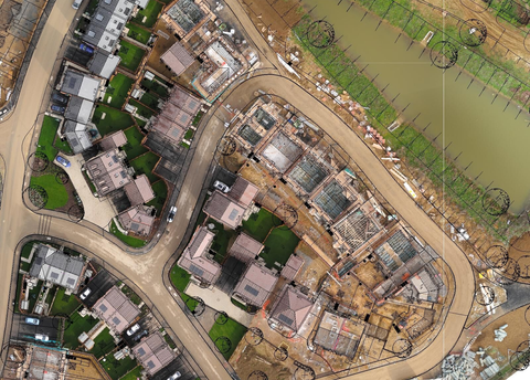
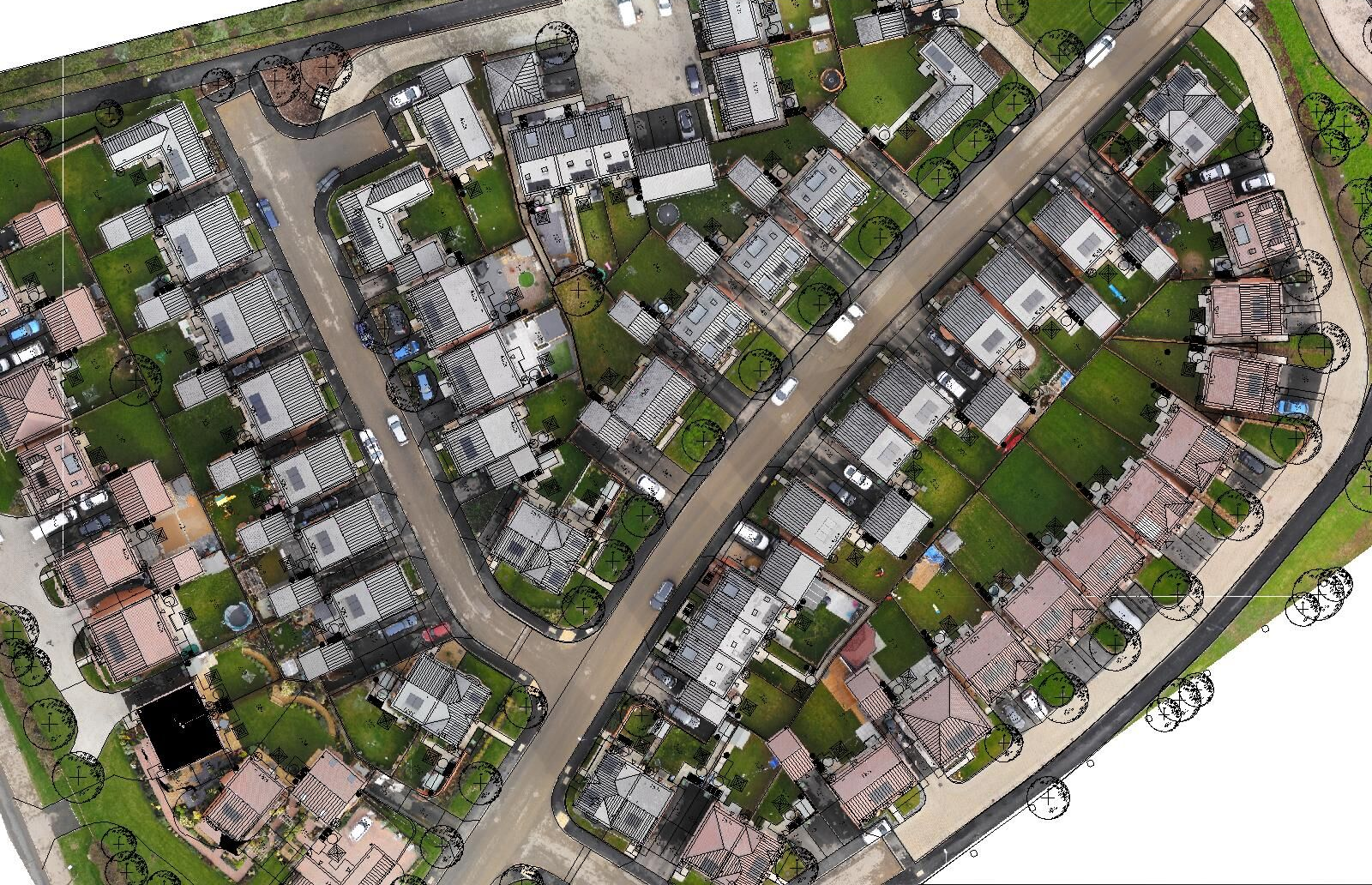
Ortho Mosaics
2D Geo Referenced ortho mosaics. Allowing for full conformity checks and comprehensive asbuilt information.